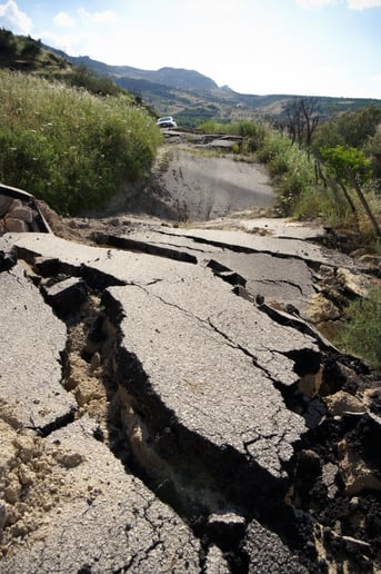
 Our planet is not a solid piece of rock, but rather a boiling slush of magma, with slight movements across the surface hinting at the dynamic inner depths of the planet. Sometimes, the evidence of that inner activity is unleashed as a massive release of energy that rends and shakes the surface of the Earth — a.k.a, an earthquake.
Unlike most natural processes, geology happens over immensely long time frames. Earthquakes (and their Volcanic cousins) occur at intervals that are sometimes longer than the entirety of human history. Interestingly, earthquake records actually comprise some of the earliest historical records we possess.
For example: The earliest recorded earthquake was in 1831 B.C. in Shandong Province, China. Along with the Chinese, the ancient Greeks also recorded earthquakes, and we have a rich historical record of earthquakes in Europe and Asia for the past 3,000 years. In fact, Aristotle did work on the natural science of earthquakes — he recognized the correlation of soil type to damage potential in an earthquake around 350 B.C.
It was not until the 18th century that the cause of earthquakes was understood, when John Michell correctly described how they are triggered and how they travel through the surface of the Earth. In 1760, he correctly identified the epicenter of the recent earthquake that devastated Lisbon (an event which helped launch the global business of property insurance, once it was established in Britain after the Great Fire of 1666). Since then the globe has been covered in sensitive instrumentation to record the faintest traces of motion on the surface of the Earth, including 10,000 earthquakes annually in California alone.
Earthquake is thus the natural peril that has been covered by insurers the longest. Furthermore, geological surveys form the core of some the oldest mapping institutions around the world. This long history, as a natural phenomenon and as an insurable peril, has led to great sophistication around how earthquake activity is recorded and, more recently, modeled — particularly by the cat model vendors (AIR Worldwide, RMS, EqeCat). Indeed, there is ample opportunity to model earthquake because of the variety and richness of datasets that describe different aspects of predicting the occurrence and effects of an earthquake.
An equally devastating peril associated with earthquake is tsunami, which are gigantic walls of water sent over coastal areas by earthquakes beneath the ocean. These require their own modeling expertise, being a blend of earthquake and flood models.
The areas vulnerable to earthquake are well known by reading the news. Central Asia (from Iran to Nepal), Southern Europe, and the Pacific Rim are all well known earthquake zones. However, there are areas thought to be vulnerable to earthquakes that haven’t experienced them in living memory. In North America, this includes the Fraser Delta and the St. Lawrence seaway.
There are four sets of geological information that are widely used by insurers to guide their earthquake underwriting: soil type (as per Aristotle 2,370 years ago), distance to fault line (as per Michell 255 years ago), peak ground acceleration (as detected and recorded by ultramodern equipment), and return period (as predicted by a combination of close monitoring of the grounds movements and history). In my next few blog posts, I’ll explore these different types of information, along with tsunami, and how they can be used by insurers to effectively underwrite the risk associated with such a destructive and unpredictable peril.
