
Satellite imagery inherently contains distortions caused by factors like sensor orientation and topographical variation. The correction of these distortions is referred to as orthorectification. There are a few approaches to apply these corrections. Which one to take depends on the use case, operator skill and knowledge, as well as resources available.
The first approach is to purchase orthorectified imagery directly from the satellite provider. However, this solution generally relies on low-resolution digital elevation models (DEMs), resulting in imagery that is not adequately orthorectified. Orthorectification requires a high-resolution DEM to provide an accurate result. Inadequately orthorectified imagery may lead to errors and inaccurate results if the imagery is being used for direct measurements and feature extraction. This can lead to problems in future applications that can be more expensive to overcome than what is necessary to ensure accurate satellite imagery.
|
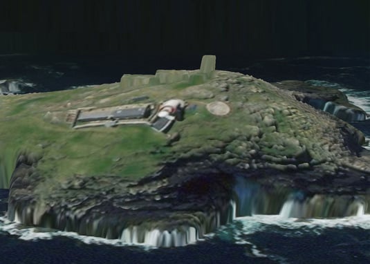
This image shows the lighthouse displacement in the free orthorectified image. |
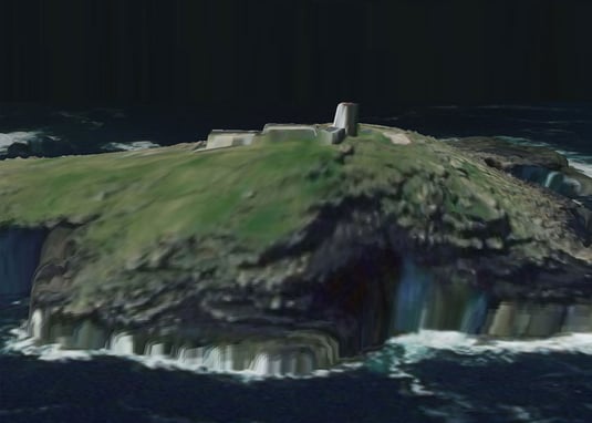
This image was orthorectified by Intermap, which shows the lighthouse in the accurate location draped over the DEM. |
The second approach is to order satellite imagery in an ortho-ready state and perform the orthorectification in-house. Ortho-ready imagery contains all relevant image support files, allowing a proficient user to apply the necessary geometric corrections themselves. A major drawback of working with ortho-ready imagery is obtaining a high-resolution DEM, knowledge and software required for the user to perform the orthorectification. A high-resolution DEM is costly to acquire when the only use is for orthorectification, and while there are free elevation datasets like SRTM available to use, it will not achieve the desired image accuracy.
The third approach is to order imagery in an ortho-ready state and hire professional service to do the orthorectification. With this approach, there is no need to have software and skill to perform orthorectification; however high-resolution DEM is still required to purchase on top of the orthorectification fee.
To overcome the drawbacks mentioned above, Intermap offers an orthorectification service to provide satellite image orthorectification that leverages a high-resolution, proprietary DEM database. This service provides all the orthorectification components in a cost-effective way. The value added by Intermap’s Orthorectification Service means that the resulting product is far more accurate, and therefore can reduce project time and cost.

COMMENTS