Intermap’s radar imagery provides users with an unprecedented view of what lies beneath. Beneath the clouds. Beneath the tree canopy. Even beneath the Earth’s surface.

We produce high-resolution imagery and elevation models through simultaneous X- and P-band collection – revealing dangers that may remain hidden if you rely on multispectral imaging alone.

Hydro and Sub-Canopy Mapping

P-band radio waves penetrate through multi-canopy vegetation, enabling identification of natural and man-made features that are hidden from view when using optical or LiDAR mapping techniques – providing tactical awareness of objects and features such as vehicles, fences, buildings, trees, roads, rivers and more. 

PBand.png
Picture4.png

P-band Imagery

X-Band Imagery

Wires and IEDs

Using our proprietary collection mode, Intermap can detect threat items like IEDs or command wires – even beneath the ground’s surface. Using polarimetric imagery and change detection, a sample IED and command wires were identified (shown below, highlighted in red). The wire is only visible via HH polarization and would not be detectable with other technologies.
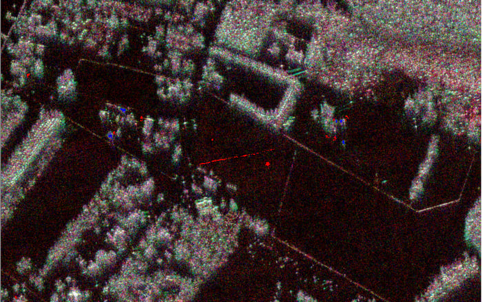
Area 2 New P-Band Imagery 3-channel HH_VV_HV

LearnMore-01