
Using high-resolution data is an efficient way to evaluate tower locations. It can help identify obstructions that can block signals, thus reducing the need to physically survey each path.
Link Planning Criteria
Link planning is the process of planning cell tower sites to evaluate coverage and network capacity. One of the most important aspects of link planning is calculating line-of-sight between two antennas, typically located on a tower. To do this reliably, you need high-accuracy earth observation data that reveal obstructions. The farther radio frequencies travel from the transmitter, the weaker they become. When obstructions are present, such as buildings, trees and other surface features, signals are attenuated further, or completely blocked. RF signals can also be absorbed by atmospheric gasses and heavy rain, which must be accounted for as they affect signal strength.
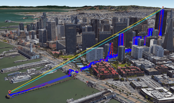
Line-of-sight allows the network planner to see what obstructions exist between a transmitter and receiver and evaluate if such a link is possible. Two common link analytics that provide line-of-sight details:
- Link Profile: point-to-point analytic showing line-of-sight and Fresnel zone versus potential obstructions
- Viewshed: line-of-sight visibility from a transmitter to multiple receiver points in a given radius and direction
Types of Terrain Data
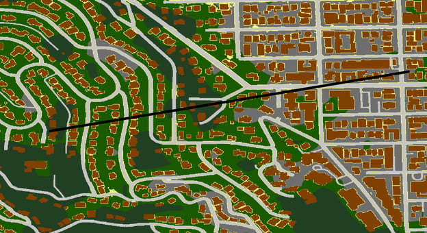
Terrain data provides the basis for 3D analysis as it is a model of the physical surface of the earth. Terrain data comes in various models, each with an important distinction:
- Digital Surface Model (DSM): Includes all features on the surface
- Digital Terrain Model (DTM): Shows ground surface with features removed
- Digital Height Model (DHM): Shows height of objects above ground level
There are many different datasets available to the telecom industry, but as with any data there are pros and cons to each. Some important factors to consider include coverage, accuracy and currency. In general, DEM data comes from the following sources:
- Public Terrain Data: low-resolution, basic detail, free, global coverage
- Satellite Based Terrain Data: varying resolutions, continually updated, penetrates cloud cover, global coverage
- Airborne Terrain Data: high-accuracy, long gaps between collection times, high-cost, localized coverage
Clutter Data
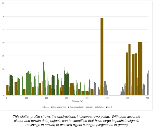
Clutter data is important when determining line-of-sight as it allows you to distinguish between types of obstructions and features on the surface. Clutter type information is classified into categories such as bare earth, light and heavy vegetation, urban, buildings, roads, and water. This is important because RF signals penetrate and reflect through materials differently and can therefore be modelled appropriately. For example, signals can penetrate light vegetation but will get blocked by concrete buildings, so it’s important to be able to distinguish between different clutter classifications.
What data do I need?
There are different formats available for both terrain data and clutter data, with varying levels of quality. Factors such as sensor type, vertical accuracy, resolution (post spacing), acquisition and processing techniques all influence the suitability of data for applications. There are also economic considerations to each dataset, as well as practicality (some datasets are just too big). The kind of data that is required for specific applications is certainly an area of interest and requires an in-depth discussion. This will be a topic for future blogs.
We at Intermap Technologies® are passionate about geospatial technology and its applications. In this series of blogs, we'll explore why earth observation data is critical to network planning by breaking down the key components of a successful link plan.

COMMENTS