
Transform Raw Imagery into Analysis-Ready Information
Orthorectification is a process used to correct or transform satellite or aerial imagery to accurately represent terrain and features. Orthorectification results in true-to-scale images that can be used for various purposes, such as analyzing land use, ground measurements, monitoring changes and map creation. Intermap’s Orthorectification Service utilizes its high-resolution digital terrain models (DTMs) to correct distortions in imagery, providing customers with a reliable way to accurately visualize geospatial information from any source.
Leverage precise, globally available NEXTMap® elevation datasets with production-grade orthorectification processing infrastructure to transform raw satellite imagery into analysis-ready imagery. Service provides customers with accurate and consistent geometry throughout an image or image set, regardless of image source, with the option to incorporate imagery from multiple vendors and collection times.
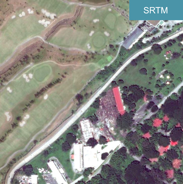
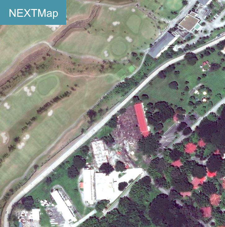
See the difference between the two datasets by moving the slider
All-in-one orthorectification package combines elevation datasets and orthorectification processing in one pricing structure
Scalable computing capacity ensures timely processing of imagery
Multiple optical and radar imagery sources are supported
Based on our unique, precise NEXTMap DTM datasets, starting at 1-meter accuracy and resolution in low slope and unobstructed areas
Precise terrain features in DTM accurately corrects raw satellite imagery to produce analysis-ready imagery that is free of distortions

Intermap’s Orthorectification Service supports optical and radar satellite sensors using a rational polynomial coefficient (RPC) sensor model
1In low slope and unobstructed areas
2NEXTMap One regional covers the United States, Western Europe and parts of Southeast Asia
