Renewables-Web-Header-image-1

Renewable Energy

Drive Efficiency with Geospatial Data Solutions

Globally Available Elevation Models

Intermap empowers renewable energy companies to save money and solve project planning and site assessment challenges. When budgeting and permitting for new wind and solar projects, planners perform modeling and analysis that rely upon data availability, consistency and quality. Our comprehensive, high-resolution NEXTMap® elevation data offers the most homogenous and accurate elevation products on the market at a global scale.

Geospatial Data Solutions

  • Simplify exploration, assessment and site development with easy access to globally available elevation data
  • Execute projects quickly and efficiently with Intermap’s data services while staying within the project’s budget
  • Expand areas of operation to meet the growing demand for renewable energy with accurate and consistent data
  • Save time and money and increase resource visibility by ensuring that data as a service is available across the entire enterprise
  • Access elevation data through subscriptions for Global Mapper, WCS and WMS custom solutions, and tailored slope and aspect maps through APIs

Applications include:

  • Slope, aspect and contour map generation
  • Cut and fill estimations
  • Road and transmission corridor planning
  • Environmental impact studies
  • Site visualization

See the Difference

NEXTMap elevation data dramatically reveal terrain and surface features that are missing in other datasets

Free-SRTM-DSM
NEXTMap-DSM

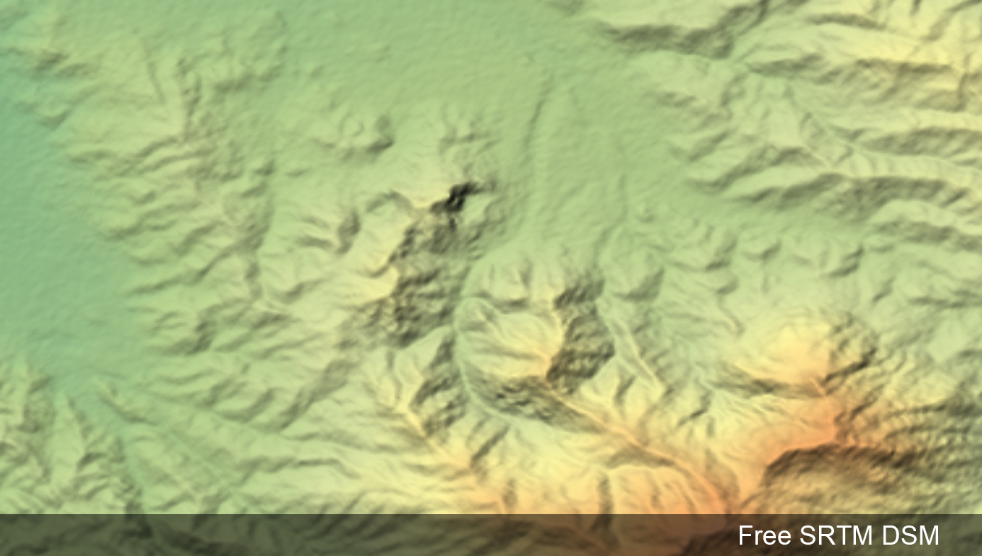
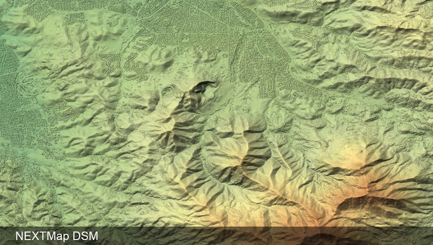
See the difference between the two datasets by moving the slider

Global-Mapper

Access Global Data in Global Mapper

Intermap and Blue Marble are proud to offer instant access to NEXTMap elevation data through Global Mapper software. Get instant access to 160 million+ square kilometers of high-resolution NEXTMap elevation for the entire globe.

Global Mapper features:

  • Perform detailed terrain analysis, generate contour and evaluate slope and aspect within the powerful Global Mapper software
  • Access to digital surface and digital terrain models
  • NEXTMap elevation data is continually updated so customers have access to the latest data
  • Simple low-cost annual subscription

NEXTMap Data Specifications

Coverage
Global
Product Type
DSM, DTM
Date
Varies by region, archive datasets and current, continually updated datasets available
Resolution
up to 1m
Vertical Accuracy (LE90)
up to 1m (depending on area)
Horizontal Accuracy (CE90)
up to 3.5m (depending on area)
Compatibility
Fully compatible and tested with 100s of GIS applications, engineering tools, design tools and 3D visualization
Applications
3D visualization, geological mapping, watershed analysis, orthorectification, cartography, engineering, site exploration, suitability assessments, forestry, strategic planning, national maps, cartography

Learn more about our NEXTMap elevation data products here.