Intermap’s history begins in 1919 when its predecessor, Pennsylvania Aero Service Corporation, was founded as North America's first aerial survey company. In 1920, it changed its name to Aero Service Corporation.
|
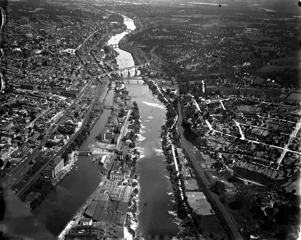
Aero Service Corporation, 1921. Aerial view of the Schuylkill River looking southeast from the vicinity of Fountain Street in Manayunk, Philadelphia. https://www.librarycompany.org/ |
1919Intermap’s founding company, Pennsylvania Aero Service Corporation, became the first aerial survey company in North America. Aero collected the first aerial imagery of Pennsylvania by mounting a camera on an aircraft. Aero Service Corporation is the oldest flying corporation in the world. Aero used aircraft to collect aerial photos of Philadelphia using a 20-inch focal length glass plate camera attached to the plane’s cockpit cowling. |
|
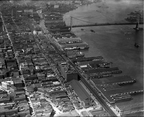
Aero Service Corporation, 1928. Benjamin Franklin Bridge, Old City Historic District, Philadelphia. |
1928In 1928, Aero completed an aerial survey in Philadelphia covering 4,000 square miles. |
|
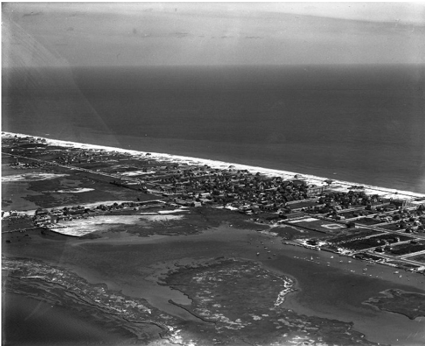
Aero Service Corporation, 1931. Aerial views of the seaside community of Beach Haven on Long Beach Island, New Jersey. |
1932In 1932, Aero collected aerial imagery for the entire state of New Jersey, marking the first time a complete state was photographed. |
|
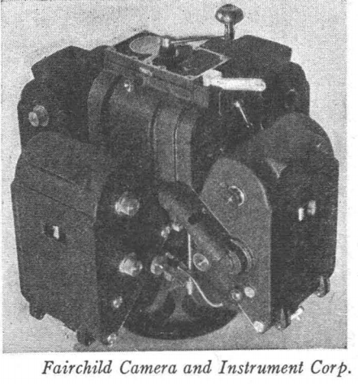
Fairchild T-3A Five-Lens Camera used by Aero Service to survey for the TVA from 1936-1937. Aerial Cameras and Photogrammetric Equipment: A Quarter Century of Progress, Revere G. Sanders, Fairchild Camera and Instrument Corp. |
1934In 1934, the Tennessee Valley Authority required development of the potential resources of the 43,000 square miles of the Tennessee River Watershed. Topographic map coverage at scales of 1:62,500 and 1:125,000 was sparse. Aero Service was awarded a contract to produce the aerial photography and compile mosaics. Aero assigned two "Fairchild 71" aircraft, each equipped with a camera. All flight layout, film processing, printing, mosaicking, copying and reproduction were completed by Aero. The camera used resulted in a central vertical and four oblique negatives simultaneously. The side oblique views (43⁰ from the vertical) were transformed in a special printer to near-verticals. Each mosaic board covered 7.5 minutes of longitude and 15 minutes of latitude, at a scale of 1:20,000. |
|
Aero Service Corporation, 1939. Aerial views of the area of West Philadelphia at 30th and Market Streets. 30th Street Station and the Main Post Office are visible, as are several bridges crossing the Schuylkill river. |
1938In 1938, Aero compiled precise photo-mosaics of 11,000 square miles of Utah for the Soil Conservation Service. Aero photographed the project areas and rectified the photos to fit the specifications. The rectification was accomplished with a precision rectifying camera designed and built by Aero. Aero participated in several important projects, including work with the U.S. Geological Survey and for the European and Pacific theaters during World War II. |
Source: Photogrammetric Engineering and Remote Sensing, Vol. 50, September 1984
back to top|
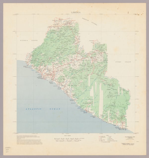
Planimetric map, Liberia. Scale 1:1,000,000. Published in 1957 by the U.S. Coast and Geodetic Survey from shoran-controlled mosaics of aerial photographs of 1953 by Aero Service Corporation, Philadelphia, PA. |
1961Aero Service Corporation was acquired by Litton Industries to become a mapping and survey division of Litton. |
|
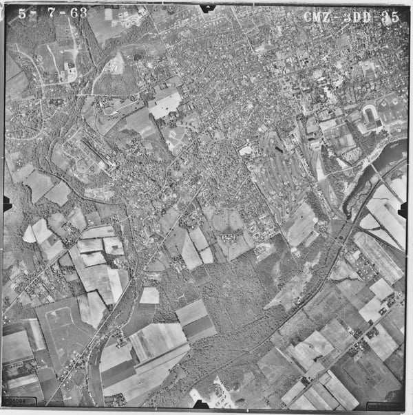
Aero Service Corporation. Princeton Aerial Photograph 5-7-1963 (CMZ-3DD-35). |
1974Aero Service Corporation merged with Western Geophysical Company of America, another division of Litton, where it was dedicated to the creation of maps and aerials and aerial surveys. |
|
Synthetic Aperture Radar (SAR) sensors are located in the RF transparent radome beneath the aircraft. |
1977Intera Information Technologies acquired Western Geophysical Company's remote sensing group. |
|
STAR-1 system aboard a Cessna Conquest was used for ice reconnaissance when Intera won the contract with CANMAR in 1983. |
1983Intera won a three-year contract with Canadian Marine Drilling Ltd. (CANMAR), a subsidiary of Dome Petroleum, to monitor shipping lanes in the Beaufort Sea. Intera developed surveillance devices billed as the most advanced commercial ice early warning system in the world. The STAR-1 system (Sea Ice and Terrain Assessment Radar) allowed drill ships to identify ice floes as small as 15 - 20 meters in size previously overlooked by other devices. Under the contract, Intera set up the STAR-1 surveillance flights from Inuvik, N.W.T. on a daily basis during drilling at a well named Kogyuk N-67. |
|
|
1992From 1992 to 1996, Intera was involved in the Central African Parks project creating topographic maps for all of Africa’s tropical forest parks. Around the same time, Intera also operated STAR-2 for ice reconnaissance to support arctic shipping lanes and operated STAR-1 for terrain mapping around the world. |
|
Learn more about Intermap’s history with DARPA here. |
1996Intera split into three groups: Intera Environmental, Schlumberger (acquired the petroleum portion), and Intermap (remote sensing group). Intermap acquired the world’s most advanced terrain data collection system from DARPA. |
1997Intermap became a listed company, focusing on acquiring companies involved in remote sensing. |
|
|
Present DayIntermap is always building new solutions and its growing geospatial library powers AI-driven algorithms, making each new solution faster, more affordable and richer in information. Intermap distributes products and solutions globally, with simple and light-weight architecture, through the cloud, or behind a firewall. Whether the requirements are for better terrain awareness, change detection, feature extraction, foundation mapping, or predictive analytics, customers on every continent can leverage Intermap's architecture to maximize their geospatial investment. Intermap’s vertically integrated products, solutions and software simplify many large-scale terrain data challenges and make the solutions accessible to non-expert users. |
Your World.
Made Simple.
back to top|
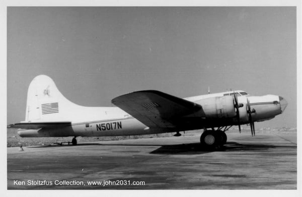
N5017N in Beirut, Lebanon in 1961. |
|
Aero Service Corporation operated N5017N, a Boeing B-17 bomber, from 1949 until 1962. During the 13 years, the aircraft flew almost one million miles, which is enough to circle the globe more than 35 times. Prior to Aero’s purchase of N5017N, the aircraft was used to ferry fresh shrimp to east coast markets as it was manufactured too late to participate in WWII. |
|
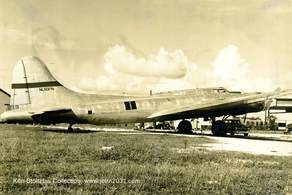
N5017N at an airport in the 1940s. |
|
N5017N was flown all over the world, flying at 30,000 feet, to collect aerial imagery for various mapping projects. During September and October of 1956, the aircraft flew 44 consecutive days to obtain photo coverage of 150,000 square miles of Saudi Arabia. |
|
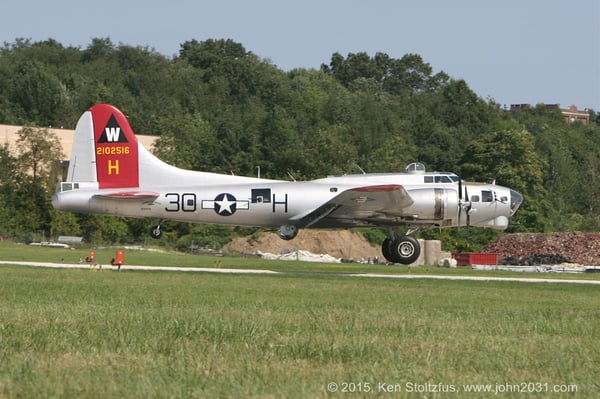
N5017N landing in Ohio in 2006. |
|
In the summer of 1962, the aircraft was sold to Chris D. Stoltzfus & Associates, of Coatesville, PA, to be used for forestry dusting operations and fighting forest fires. On March 31, 1981, N5017N was donated to EAA restoration program to maintain the aircraft in airworthy condition. |
Sources: Prop Wash Magazine, 1962 October Edition.
Ken Stoltzfus Collection, www.john2031.com.