Intermap has a long history of providing geospatial data and services under the U.S. Geological Survey (USGS) Geospatial Products and Services (GPSC) contracts.
|
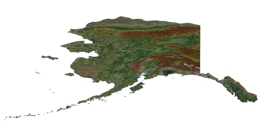
The entire state of Alaska has been mapped to national mapping standards through task orders under the GPSC suite of contracts. |
|
Intermap brings expertise in IFSAR collection and geospatial analytics to the Dewberry team on its recently awarded U.S. Geological Survey (USGS) Geospatial Products and Services (GPSC4) prime contract. The GPSC4 contract began in August 2021 and will continue until February 2027, with a contract ceiling of $850 million. This new contract includes elevation data collection and processing, hyperspectral and multispectral remote sensing, airborne geophysical surveys, and the production of elevation-derived hydrography for updating the National Hydrography Database (NHD). The NHD is part of the USGS 3D Hydrography Program (3DHP) and will provide high-resolution data representing water flowlines and estimating stream flow volume and velocity. The Company has been a subcontractor on the USGS GPSC contracts since 2010, collecting, processing and delivering IFSAR elevation data and orthorectified radar imagery in support of the USGS 3D Elevation Program (3DEP) Alaska Mapping Initiative. |
|
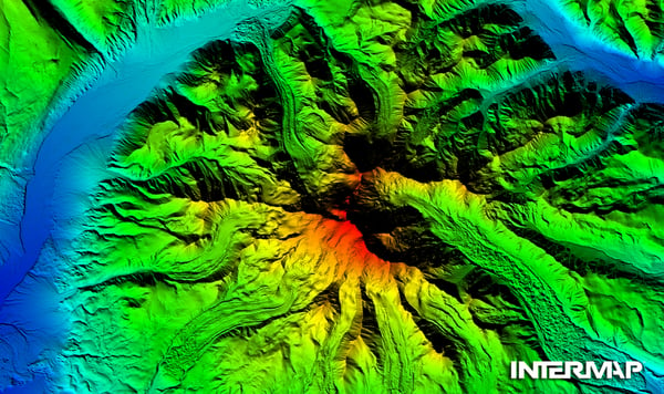
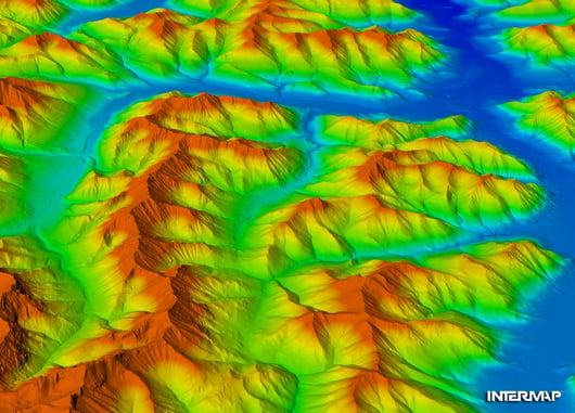
Digital elevation model of the Red Dog Mine, Alaska. |
|
The USGS GPSC contracts are used to facilitate interagency cooperation to address a wide range of geospatial needs. Prior to 2010, the State of Alaska lacked elevation data that satisfied National Map Accuracy Standards at any scale, and there was an urgent need for accurate 3D mapping to improve aviation safety. Accurate elevation data were also needed to update statewide base maps used in applications supporting critical minerals and natural resource development, environmental monitoring, flood risk mitigation, infrastructure development and national security. Intermap provided USGS and partner agencies with an IFSAR solution that met stringent accuracy requirements across the rugged, remote and often cloud-covered area. Over the course of 10 years, Intermap was tasked via the USGS GPSC2 and GPSC3 contracts with collecting and delivering seamless 5-meter digital elevation models and cloud-free 62.5cm orthorectified radar imagery for over 1,150,000 square kilometers, covering 78% of Alaskan territory. Intermap’s data consistently exceeded all contract specifications, bringing Alaska’s outdated state maps up to national mapping standards. |
|
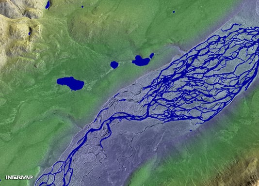
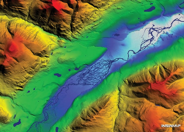
Digital surface model with ORI overlay in the Killik River region in Alaska. |
|
Through the Alaska Statewide IFSAR Mapping Initiative, all of Alaska was successfully mapped and updated, on time and under budget with a total cost of $66.3 million, less than the original estimate of $77.3 million. The cost savings were made possible by efficient statewide flight planning, innovations in data processing and proactive data acquisition by Intermap and partners. With IFSAR collection for Alaska complete, USGS is now acquiring commercial satellite imagery that will be orthorectified using the IFSAR elevation data. IFSAR orthorectified radar images (ORIs) can be used to pan-sharpen color orthoimagery, improving optical satellite images impaired by clouds. |
|
Intermap’s Learjet getting ready to take flight in Alaska on a rainy day. Intermap’s all-weather collection platform was key in collecting IFSAR data in Alaska due to almost constant cloud cover in certain regions. |
|
Intermap's Alaska IFSAR data are currently being used to improve the economy, quality of life and safety of all Alaskans, while satisfying needs for critical minerals and natural resources, flood hazard modeling and climate change adaptation as new Arctic shipping routes become viable. These data bring enormous value to citizens today and will be even more valuable over the coming decades as they provide an accurate baseline from which to measure change. |
Between 2010 and 2020, under the USGS GPSC2 and GPSC3 contracts, Intermap fulfilled 23 task orders for LiDAR and IFSAR data collection and processing with total value of all task orders exceeding $42 million.
The GPSC2 contract began in 2010 and ended in 2016. The contract ceiling was $35.7 million, with $23.9 million awarded through 75 task orders. The prime team Intermap was on received $8 million (33.3%) of the awarded funding through 22 task orders.
|
|
Learn more about Intermap’s work on the GPSC suite of contracts below.
The Challenges and Joys of Mapping America's Last Frontier
|
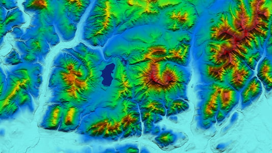
Digital terrain model of the Gates of the Arctic National Park and Preserve. |
|
Digital elevation model of the Killik River, Alaska. |