Intermap operates multiple FAA-certified Learjet-36 platforms for custom airborne IFSAR data collection. Our aircraft operate as C4-ISR platforms and fly at high speed and high altitude. We have wide-area collection capabilities and use IFSAR remote sensing techniques to provide 3D positioning and imaging using high-accuracy imaging radar. We have decades of experience deploying this multi-sensor technology in over 60 countries worldwide.
Intermap’s multi-band approach provides key tactical advantages for deployment, unrestricted by daylight, weather, cloud cover or foliage. We augment our proprietary multi-sensor IFSAR data as well as third-party LiDAR data with satellite imagery for unprecedented situational awareness. Custom collection options are also available to suit your mission requirements.
Check out this feature article about our airborne IFSAR collection in LIDAR Magazine here.
Intermap's commercial airborne collection features high-altitude multi-frequency ISR, triple-canopy foliage penetration, high-resolution global elevation data and analytics platform for exploitation and dissemination of data
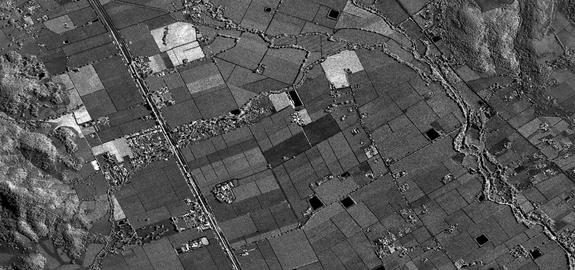
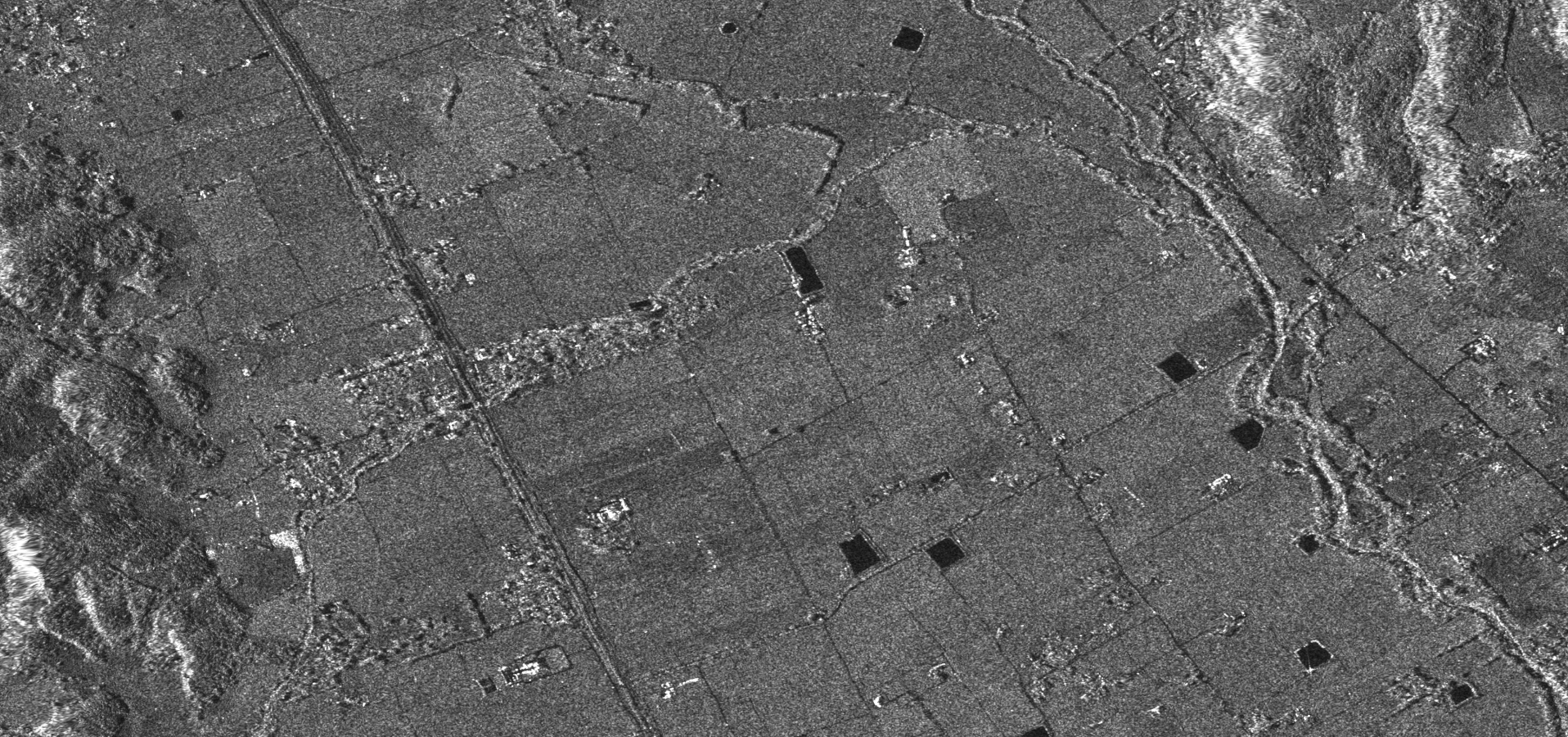
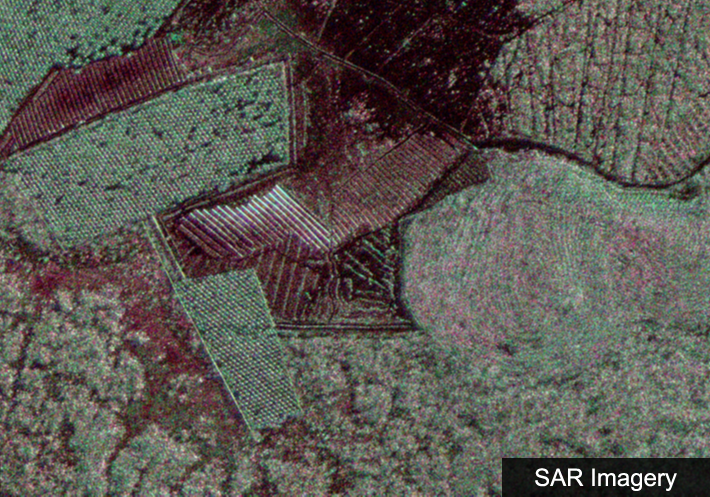
Intermap collected airborne SAR data over Napa Valley, USA. The image slider shows 1.5m resolution X-band orthorectified SAR imagery from a satellite sensor (left) and Intermap’s airborne sensor (right). Airborne SAR contains more detail and contrast due to the higher signal-to-noise ratio.
Alaska Mapping Initiative
Intermap was responsible for delivery of over 1.5 million km2 of reflective surface and bare-earth elevation content and orthorectified imagery to Alaska stakeholders. We also provided custom content derived from the baseline elevation data including slope, contour layers and hydrology information.
Deliverables included:
Alaska IFSAR acquisition supports the broader national 3D Elevation Program. For more information, visit Alaska Mapping Initiative.

Peninsular Malaysia Collection
Intermap provided simultaneous collection of high-resolution X-band and P-band imagery over Peninsular Malaysia, an area of approximately 130,000 km2, in just 35 days. We also conducted hybrid DEM fusion services for 30,000 km2 LiDAR data, and over 24,000 km2 of satellite SAR data.
Deliverables included:

Philippines National Mapping Program
Intermap assisted in the creation of a framework for the Philippines transition to a digital economy and to support the Philippines National Mapping Program at 1:10,000 scale. Approximately 7,100 islands totaling 300,000 km2 were captured in 89 days (including the discovery of ~400 new islands) using our airborne IFSAR platform, and all collected data was processed and manually edited to create hydro-enforced bare-earth models.
Check out the news article about the discovery of 400 new islands!

Dominica: Completing an Incomplete Dataset
Intermap completed a 3D mapping project of Dominica for a LiDAR operator that was contracted to produce a DSM of the island. This initiative is part of the Disaster Vulnerability Reduction Project set out by the Government of Dominica through the Ministry of Health and Environment.
The interior mountainous region is perpetually cloud covered, making the LiDAR acquisition impossible to complete. Intermap seamlessly fused its 1m resolution IFSAR-based DSM, NEXTMap One, with LiDAR to produce a seamless, island-wide dataset. The final island-wide dataset is critical for effectively planning and managing flood control, drainage, land stability and potential landslide areas.