This is a translation of an article originally published on BIG's site
Jakarta, Geospatial News – Funding programs from the World Bank aimed at accelerating agrarian reform, including land administration, spatial planning, and the provision of large-scale basic maps as the foundation of various national strategic needs, have entered the second phase.
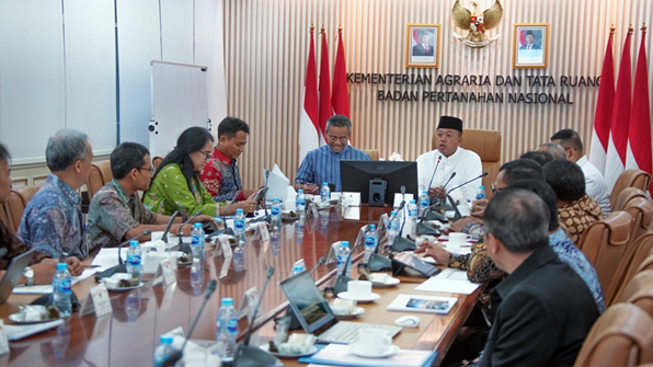
The Geospatial Information Agency (BIG), the Ministry of Agrarian and Spatial Planning / National Land Agency (ATR/BPN), the Ministry of Home Affairs, and the Ministry of Finance (Kemenkeu) held a coordination meeting discussing the project Integrated Land Administration, Spatial Planning, and Provision of Large-Scale Base Map (ILASP) period 2025-2029 on Friday, December 6, 2024 at the ATR/BPN Ministry Office.
In this project, BIG will lead the implementation of the provision of a national baseline map with an allocation of funds reaching USD 298 million. BIG Chief Muh Aris Marfai emphasized BIG's readiness by focusing on accelerating the provision of basic maps in areas not yet covered, in supporting spatial policies, disaster mitigation, investment, and management of geospatial data-based resources.
"We immediately followed up on providing a large-scale baseline map that was the foundation in supporting land administration, spatial planning, disaster mitigation, investment, and geospatial data-based policies," Aris said.
BIG has previously successfully completed the preparation of a large-scale base map for the Sulawesi region through the 2024 APBN. Aris explained that this success was the first step to accelerate the provision of basic maps in other regions.
"Sulawesi has finished providing large-scale basic maps. Next, we focus on accelerating the provision of large-scale basic maps in the Kalimantan, Java and other regions," said Aris.
Present at the coordination meeting, Deputy Minister of Finance, Suahasil Nazara gave appreciation for the planning of the mature budget, and was prepared through cross-ministerial and institutional (K/L) synergy, so that it would be easy in the process of submitting funding to the World Bank, as well as at the time of its implementation later.
"The Ministry of Finance basically supports and facilitates if the technical implementers are mature and are ready to execute this project plan. Moreover, the project budgeting plan has been well designed, and there is a similarity of vision between K/L. This will make it easier to implement the ILASP project, to support the acceleration of national development," said Suahasil.
Meanwhile, ATR/BPN Minister Nusron Wahid stressed the importance of project management based on national priorities. For the initial stages, Nusron asked to focus on Java Island ‘plus,’ before extending to other regions.
"Project management must be carried out based on national priorities. For 2025, I ask for acceleration to start from Java Island ‘plus’ before proceeding to other regions, given the spatial needs in Java with its dense population, and it is already very urgent," Nusron said.
The ILASP project is designed to answer various key issues in spatial and land reform. Based on ATR/BPN data, Indonesia still has 14.4 million hectares of uncharted parcels of land after the Agrarian Reform Acceleration Program (PPRA). In addition, there is an urgent need to draw up 2,000 Spatial Detail Plans (RDTR) that are adaptive to the issue of climate change, and support investment.
The project will also introduce three-dimensional (3D) multipurpose cadastres for thematic interests, such as disaster mitigation, as well as the modernization of more responsive and technology-based land information systems. (RKI/LR)
For more information, see BIG’s website