
Improve Safety and Efficiency with the Only Certified Terrain Data
|
Intermap has entered into a strategic agreement with Wingcopter GmbH, a manufacturer of aviation-grade drone technology and service provider for a wide range of drone deployments. This agreement reflects increased demand for NEXTView®, the world’s only government-certified, aviation-specific 3D elevation dataset. NEXTView enables UAS operators to improve flight routes and operational networks, creating a safer environment for UAVs and providing unprecedented situational awareness for commercial fleets. Wingcopter operates around the world, providing delivery, mapping, surveying, inspection and monitoring. Fly Safely. Fly Efficiently. Fly Confidently. |


Aviation applications require reliable, up-to-date data where safety is paramount. Lido Surface Data NEXTView is specifically designed for aviation applications and systems.
.jpg?width=2428&name=Germany%20flythrough%20(edited).jpg "Flight Simulator and Aviation Data")

Flight Planning. Use high-accuracy terrain information in urban and rural environments to identify new bases, distribution centers, strategic positions, obstructions and vantage points
Flight Safety. Minimize risk of collision with high-precision locations of billions of obstructions worldwide, including buildings, vegetation and terrain features
Flight Efficiency. Reduce the “uncertainty envelope” on flight paths. Determine and select optimal routes, minimize elevation gains and increase payload weight
Sensor Integration. Highly suitable for real-time sensor integration for full situational awareness. NEXTView data provides strategic overview and onboard sensors provide real-time tactical overview

NEXTView elevation data dramatically reveal buildings, terrain and other obstructions that are missing in other datasets
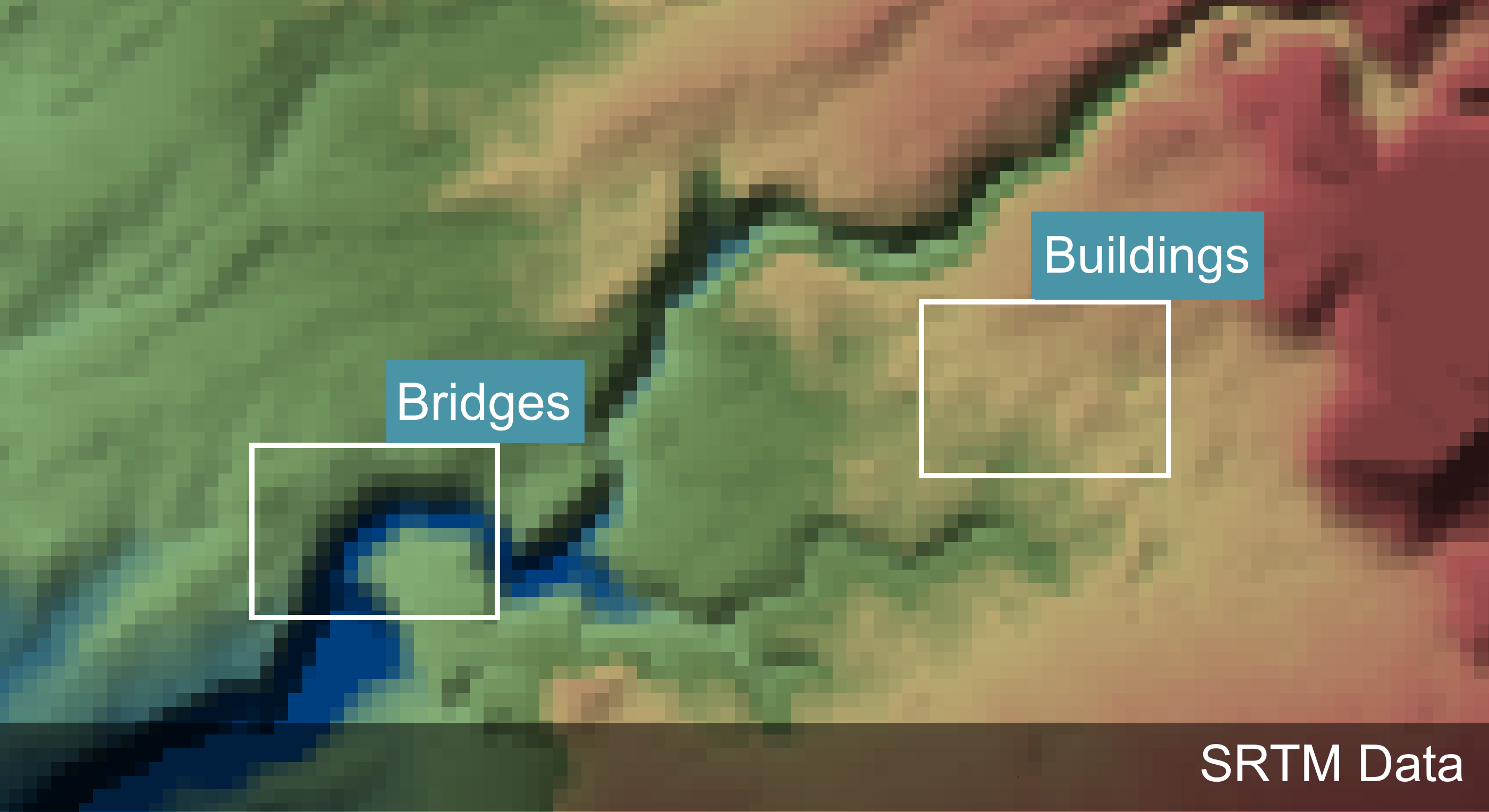
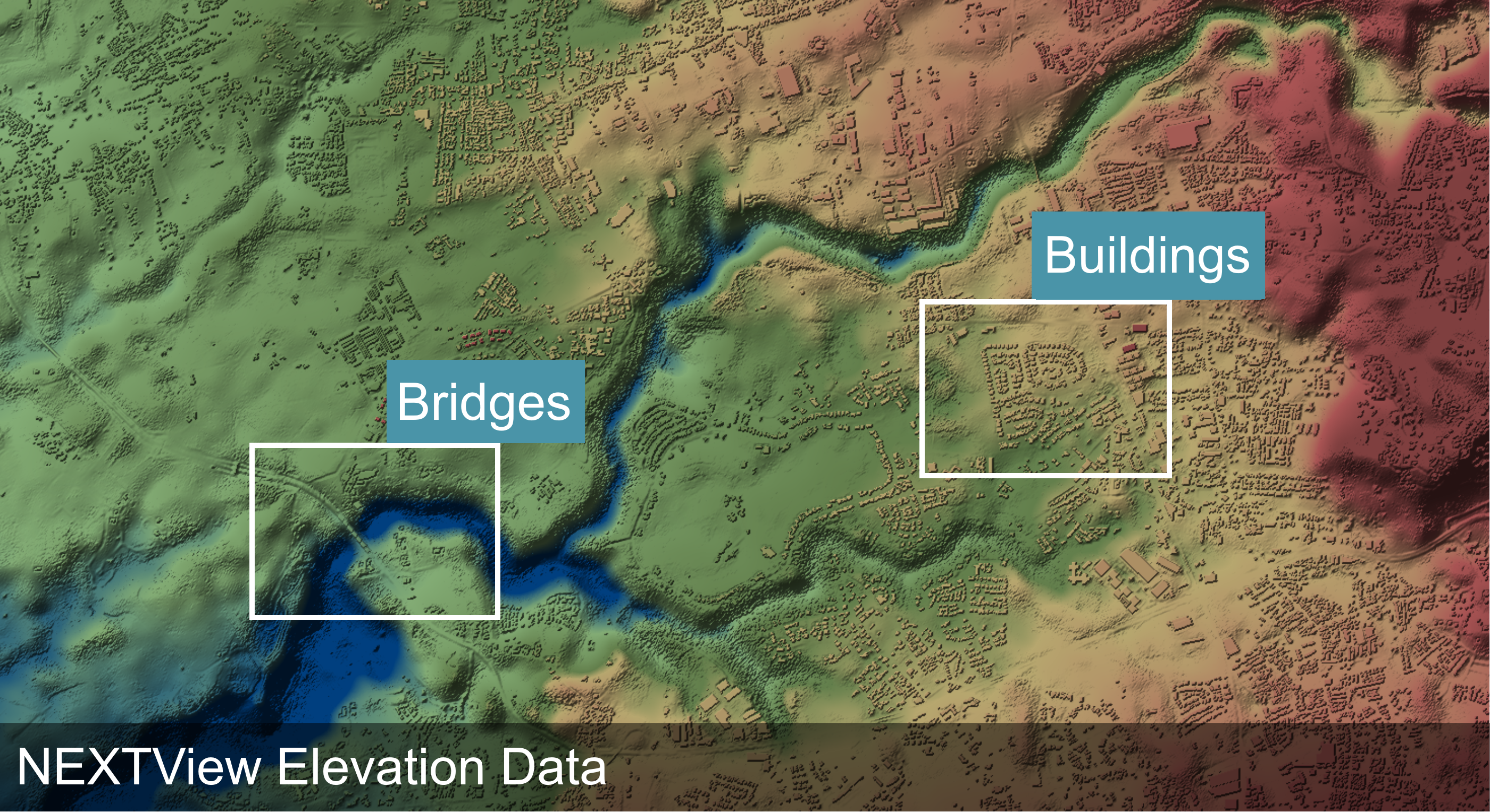
See the difference between the two datasets by moving the slider
