
When it comes to flood risk, the Federal Emergency Management Agency (FEMA)'s Flood Insurance Rate Maps (FIRMs) are the authority — and rightly so. They have decades of engineering intelligence built into them and are refined regularly. In the end, though, they are based on flood models, and as statistician George Box famously wrote, "essentially, all models are wrong, but some are useful."
A recently published report that investigated how well the FIRMs predicted flooding from Superstorm Sandy in 2012 illustrates that while they performed well in some areas, there is also room for improvement. That's because there is no flood model, or model of any natural catastrophe, that will be 100% accurate. In fact, predicting 100% of a flood event is usually a sign of a weak flood model: Imagine a model where everything within 100 miles of water is labeled as High Risk. Flood models display their quality in the zone between, “You don’t need a model to know that’s a flood risk” and “that place will never flood”. In statistical terms, the sweet spot is around 75% or 80% of flooding predicted. This is about where FEMA's FIRMs were on Sandy, but there is more to understanding flood risk than statistics.
After all the time and effort FEMA has spent perfecting the FIRMs, how is it possible to improve on what the FIRMs have to say? There are a few ways.
The first way is to compare multiple flood models. Where the models agree are the areas where the flood risk is probably well modeled. However, they will disagree in that zone between the obvious results, and looking closer at the areas of disagreement will be fruitful.
Another way to improve an understanding of flood risk is to use elevation data in tandem with flood risk maps. Regardless of how the modeling has been done, the process incorporated elevation information in some way. Using the actual elevation data lets someone visualize directly where water will flow and create the higher risk.
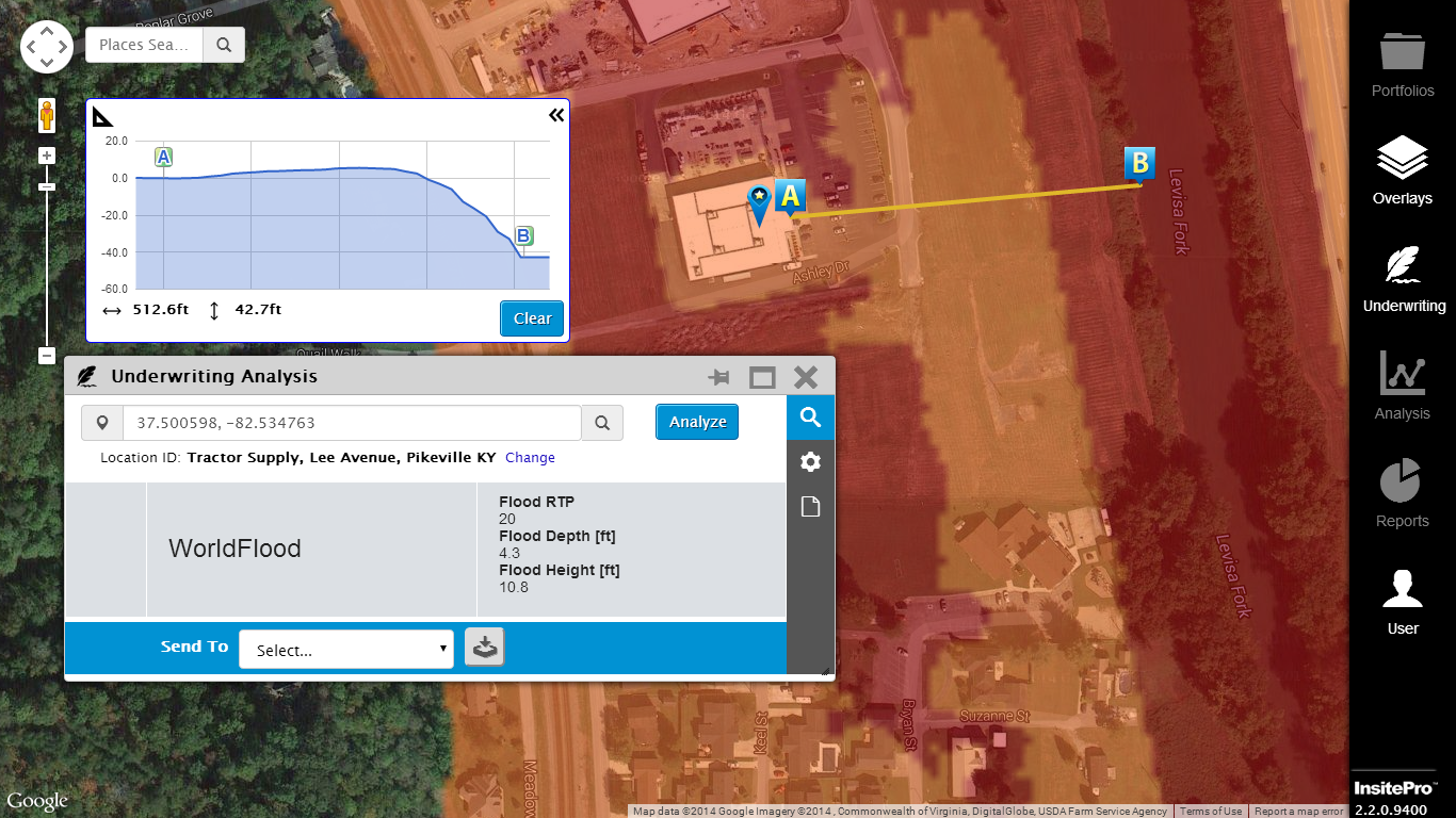
InsitePro, Intermap’s location-specific risk solution, now has features that allow users to do all this, and more. Through an intuitive profiling tool, InsitePro users have access to the world’s best global elevation datasets. With both single and multi location capability, it is now easy for InsitePro users to compare flood models and quickly understand risk from flood and other perils based on more than a single perspective.